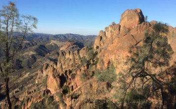
I was up in the Arroyo Seco Canyon with a friend the other day, we had made our way down to the river, what there is of it, a stagnant pool here and there was about all; my friend oversees the property and we just wanted to check on things. All is well, other than there is no river flowing; let’s hope that changes this season.
While on the drive back toward the Valley on Arroyo Seco Road, I began to go over in my mind the many small adventures I had experienced over the years in that part of the world. And I know I’m not alone in that, for decades Arroyo Seco has provided many people with memories to relive and stories to tell. And though the Canyon has seen many changes over the years, it is still a vibrant community whose inhabitants will sing its praises to all who will listen.
When we had crossed the river on the Green Bridge and we were nearing Reliz Canyon, which is just about the beginning of the Arroyo Seco Canyon, as it is the first canyon west of the flatlands… (Let me digress some to mention that my father, quoted in the headline, was a map reader and he early on taught me how to properly read a map. Every year he bought the newest version of the Rand McNalley Road Map of the United States, with Canada and Mexico pages. Looking at a map can be fascinating for some, and I’m one.)
So, back to Reliz Canyon. I’ve spent many fine times in that canyon over the years; I recall sunsets in the early 1970s, when herds of deer would come from out of the foothills into the canyon floor to feed and drink from a cattle trough near an old barn. I had a childhood classmate who lived on the Powder Horn Ranch I sometimes visited, and many years later a friend of mine, gone now, and I jogged two-mile round trips on early mornings, the scenery far better than in town.
I knew early Spanish expeditions made their way from San Antonio Mission through various canyons to reach the Salinas Valley plains, and years later during wet seasons when the Salinas River dominated the flatlands, Butterfield Stage drivers accessed Reliz Canyon then continued north to the Los Coches stage stop. When about 15 years old with a couple of older Greenfield boys in a pickup, I rode up Pine Canyon Road, opened and closed a gate or two, and came out on Reliz Canyon Road.
Recalling that little journey through the backways, I went to my maps and found that the complete Reliz Canyon Road, which follows Reliz Creek (“reliz” translated from Spanish is “cliff”), is still shown on some maps. It runs north-south from Elm Avenue west of Greenfield to Milpitas Road, very close to the Mission and Fort Hunter Liggett, intersecting with Pine Canyon Road midway. As the crow flies it is 14 miles, probably closer to 16 miles if straightened out. Of course the full routes of both roads have been blocked from public use for decades.
And when taking a cartographer’s look there are two things that stick out, to me, anyway.
One is the aforementioned Elm Avenue contains the longest stretch of straight asphalt in the county, not counting Highway 101. From its eastern terminal, snug up against the foothills at Metz Road and the Southern Pacific train crossing, it runs dead straight to the point where it curves to accommodate the western foothills, a distance of 6.2 miles. It is the only road that spans the Salinas Valley foothills and, if one adds another 1.3 miles to its terminus across the Green Bridge, it is the only road connecting the Arroyo Seco and Salinas rivers.
Two: the Salinas River is well known as a rarity in that it flows northward, there is even a book published about this anomaly, but I would add that from where it turns north, at a point once known as Johnny’s Hole a few hundred yards downriver from the Green Bridge, the Arroyo Seco River also flows north until it merges with the larger river near Soledad.
As for the boundary of Monterey County itself, it is interesting to note that our southern demarcation is Latitude 36.22° North, which starts at the Pacific Ocean coastline and runs all the way to the Nevada state line; it serves as southern boundary for Monterey, Kings, Tulare and Inyo counties and northern boundary for San Luis Obispo, Kern and San Bernardino counties.
While it appears at first glance to run true, there are two odd little jogs in the line, no more than a half degree; one is just a mile or so before State Route 395 and the town of Pearsonville and the other is a couple miles from its terminus at the state line. Two odd little accommodations that I am sure have stories attached.
***
Without a lot of fanfare, Jason Gallardo has taken over sports reporting for the Valley newspapers, stepping into the position held by Mike Ramirez. When Mike stepped away from reporting a short while ago, he undoubtedly did so as one of the most prolific writers in the history of Monterey County journalism. For over three decades, Mike surely typed out millions of words, and as any writer will tell you that is a lot of work. Covering sports is full plate, but Jason is off to a great beginning and I know he will do well.
Along the same journalistic line, a reporter is needed for the Valley newspapers. If you are someone who has seen the advertisement and are thinking about it but are unsure of all the aspects of the position, let me assure you the staff are professionals and they will get you on the path quickly. You will not regret the decision.
Take care. Peace.


